SCHeadlines

Tropics Heating Up: Forecasters Eye Disturbance That Could Become Tropical Storm Fred

It’s that time of the year again, folks. The tropics are turning up the heat and churning up new waves. Forecasters at the National Hurricane Center (NHC) are eyeing Invest 94L — now named Potential Tropical Cyclone Six — which has an 80 percent chance of tropical formation within the next…
It’s that time of the year again, folks.

The tropics are turning up the heat and churning up new waves.

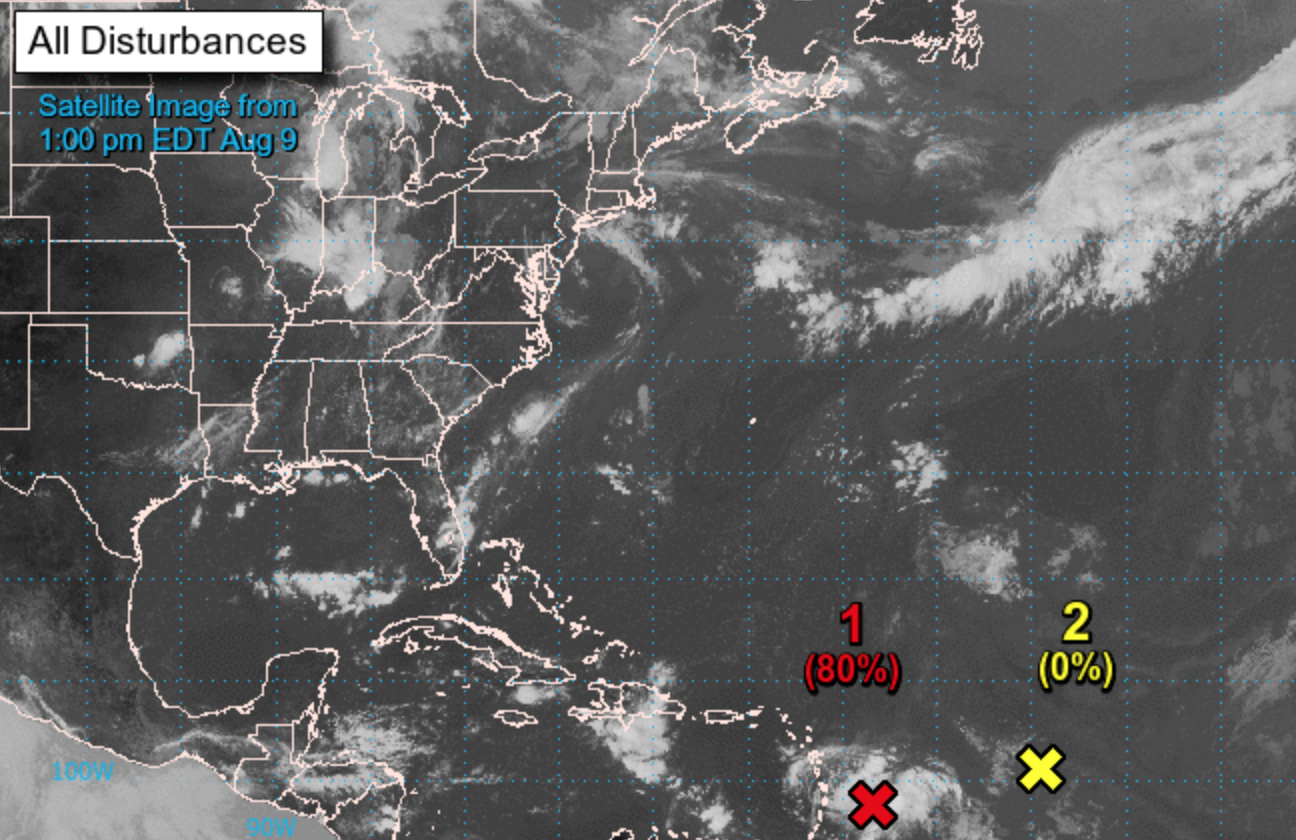
Forecasters at the National Hurricane Center (NHC) are eyeing Invest 94L — now named Potential Tropical Cyclone Six — which has an 80 percent chance of tropical formation within the next two days.

As of Monday afternoon, the area of low pressure about 100 miles east-northeast of Barbados was showing signs of organization, according to the NHC.

NHC meteorologists predict that the disturbance will likely become a tropical depression later Monday.

If the storm organizes, it would be be named Fred.

The National Hurricane Center could issue tropical storm watches/ warnings as early as Monday afternoon for the Lesser Antilles, the Virgin Islands and Puerto Rico. Heavy rain and flooding are predicted for those areas.

“This system has a window to develop as it moves west-northwestward through the Caribbean into Wednesday due to low wind shear,” AccuWeather meteorologist Bernie Rayno said.

At this point, it’s too early to predict if the system will have any impact on South Carolina.

The disturbance is predicted to move north toward Florida this weekend.

Take a look at some of the spaghetti models

Officials at the National Weather Center in Charleston said Monday morning they are monitoring the system — which won’t be a concern (if at all) until early to mid next week for South Carolina.

Forecasters are predicting an increase of tropical activity in the next 10 days.

2020 was the most active hurricane season since records have been kept in the Atlantic basin – tying marks for total depressions (31) and major hurricanes (7) and breaking the record for named storms (30).

2020 established a new record for named storms (11) which made landfall in the United States. It also tied the record for named storms (10) which underwent “rapid intensification”- or a 35-mile-per-hour increase in maximum sustained winds over a 24-hour period.

South Carolina has seen 24 hurricane landfalls since 1893 – the most recent being Hurricane Matthew in 2016 and the most infamous being Hurricane Hugo in 1989 (the state’s last direct hit from a major system). The Palmetto State was nearly hit last year by Hurricane Isaias.

Other recent close calls included Hurricane Dorian in 2019 and Hurricane Irene in 2011.

Are you ready for hurricane season? To download your official 2021 hurricane guide from the S.C. Emergency Management Division (SCEMD), click here. For information on evacuation routes in the Palmetto State, click here. And for those of you who get your info from social media, be sure to follow SCEMD on Facebook and Twitter.

Also, be sure to bookmark the National Hurricane Center (NHC), Weather Underground and the Boat U.S. hurricane tracking and resource center for the latest data on current systems …

***

WANNA SOUND OFF?

Got something you’d like to say in response to one of our articles? Or an issue you’d like to proactively address? We have an open microphone policy here at FITSNews! Submit your letter to the editor (or guest column) via email HERE. Got a tip for a story? CLICK HERE. Got a technical question or a glitch to report? CLICK HERE.

***

Get our newsletter by clicking here …

*****

Will Folks contributed to this report.

Related posts

SC

North Charleston Councilman Accuses Cop Of Falsifying Police Report

Will Folks
SC

‘Carolina Crossroads’ Update: SCDOT Set To Unveil New Plan To The Public

Will Folks
SC

Federal Lawsuit Alleges Racial Discrimination in Horry County School

Callie Lyons

Leave a Comment