
Here Comes Sally: Get Ready For Rain And Flooding This Week In SC
While there’s a “whole Waffle House waitstaff” of named storms stirring up trouble in You must Subscribe or log in to read the rest of this content.
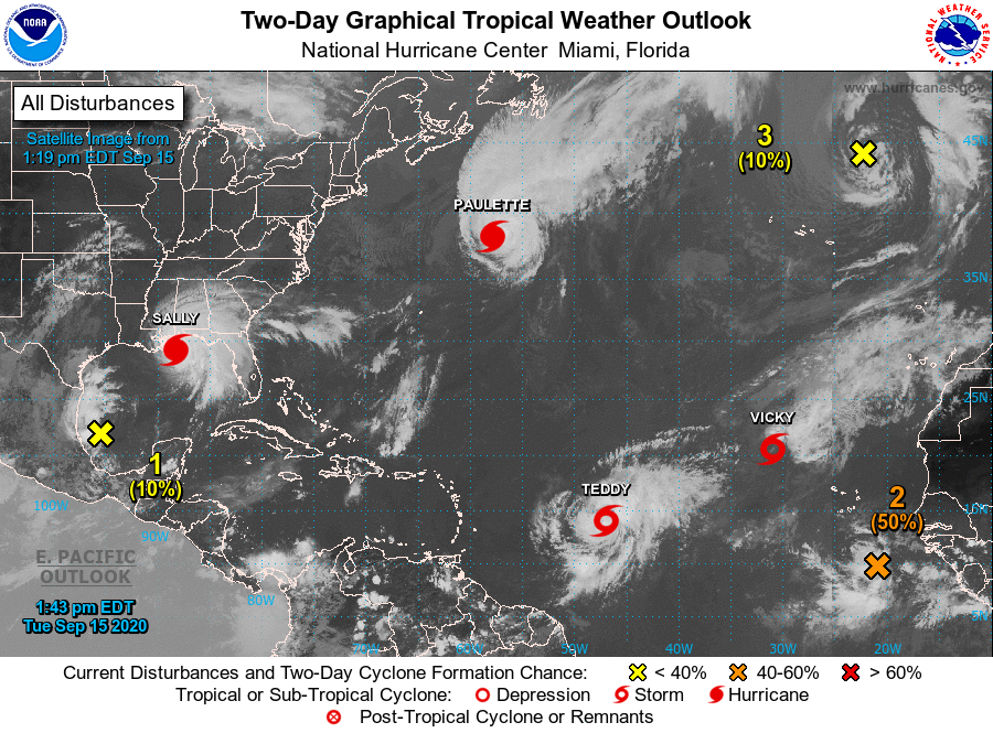
While there’s a “whole Waffle House waitstaff” of named storms stirring up trouble in