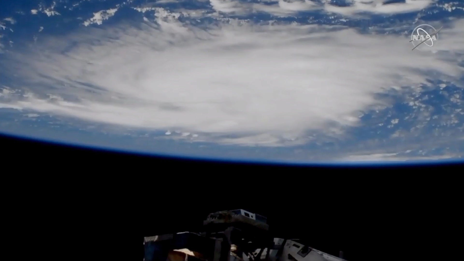
Powerful Hurricane Dorian is looking increasingly like a lock to make landfall somewhere along the Atlantic coast of Florida over the Labor Day holiday.
The storm – now a category two system – was located around 255 miles east-northeast of the southeastern Bahamas as of the 8:00 a.m. AST advisory from the National Hurricane Center (NHC) in Miami, Florida. Dorian is moving northwest at 12 miles per hour with a central pressure of 972 millibars.
Dorian is now packing maximum sustained wind of 110 mile per hour – and is projected to get stronger as it approaches the American mainland. Hurricane force wind extend outward up to 25 miles from its center of circulation, while tropical storm force winds extend outward for up to 105 miles.
“Strengthening is forecast during the next few days, and Dorian is expected to become a major hurricane later today,” forecasters warned. “Dorian is likely to remain an extremely dangerous hurricane while it moves near the northwestern Bahamas and approaches the Florida peninsula through the weekend.”
Some models are calling for Dorian to reach category four strength on the Saffir-Simpson scale (i.e. wind of 130 miles per hour or higher) prior to making landfall.
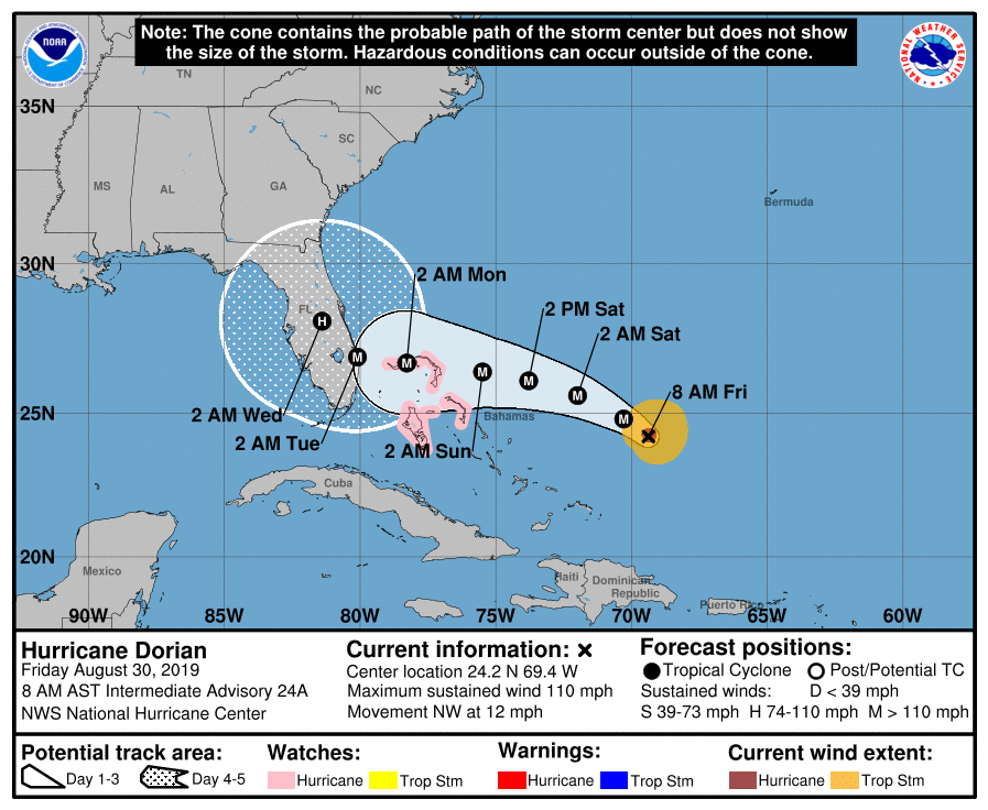
Where will it hit?
Here is a look at the latest forecast window …
(Click to view)
(Via: NHC)
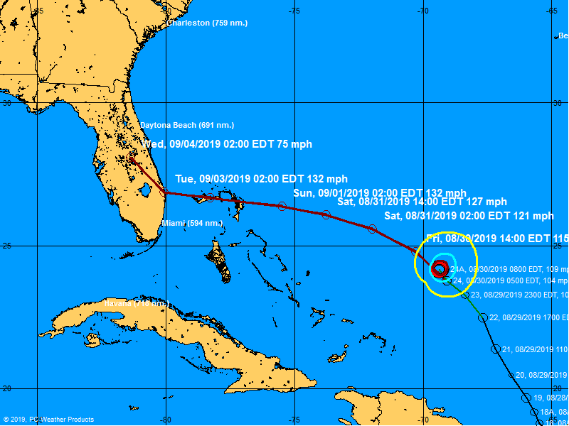
Meanwhile, here is its projected path …
(Click to view)
(Via: BoatUS)
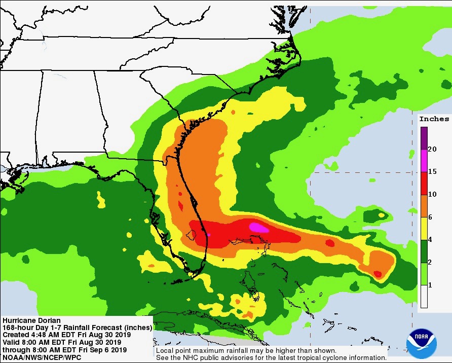
As you can see from the maps above, both the storm’s forecast window and the projected path have shifted further south since yesterday. That is good news for South Carolina officials who have been eyeing the system nervously over the last few days. However, Dorian is expected to turn to the north after it makes landfall – which could result in significant rainfall making its way toward the Palmetto State (especially in the Lowcountry).
Take a look …
(Click to view)
(Via: NOAA)
Projections of anywhere from 2-12 inches are forecast, according to Derrec Becker of the S.C. Emergency Management Division (SCEMD).
“That amount of rainfall is a part of our planning discussions,” Becker told us. “What happens in South Carolina is totally dependent on what the storm does in Florida. The next couple days will be important since it looks like Dorian has slowed down a bit.”
Needless to say we are continuing to keep a close eye on this system … as we keep the people of Florida in our thoughts and prayers.
UPDATE: And just like that … things change.
WANNA SOUND OFF?
Got something you’d like to say in response to one of our stories? Please feel free to submit your own letter to the editor (or guest column) via-email HERE. Got a tip for us? CLICK HERE. Got a technical question or a glitch to report? CLICK HERE. Want to support what we’re doing? SUBSCRIBE HERE.


