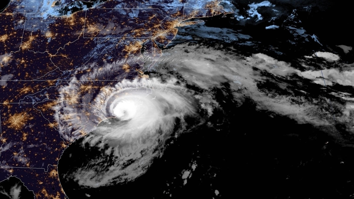
Having slowed to a crawl, a weakened but still powerful Hurricane Florence finally made landfall near Wrightsville Beach, North Carolina on Friday morning.
The skulking storm – which has stalked the east coast for the last week – moved ashore just after 7:15 a.m. EDT packing maximum sustained winds of ninety miles per hour, according to the National Hurricane Center (NHC) in Miami, Florida. That makes Florence a category one hurricane on the Saffir-Simpson hurricane wind scale.
Stronger gusts were recorded as the system moved ashore, though. One gust of 105 miles per hour was recored early Friday morning at the Wilmington international airport. Similarly high gusts were recorded at Cape Fear Community College in Wilmington.
As of 9:30 a.m. EDT, an estimated 485,000 North Carolinians were without power according to the state’s emergency management agency.
It’s bad … but it could have been a lot worse. As recently as two days ago, Florence was a category four storm with maximum sustained winds exceeding 130 miles per hour.
Breaking: #HurricaneFlorence made landfall near Wrightsville Beach, North Carolina at 7:15 am ET. @NOAA's #GOESEast satellite got a view of the Cat. 1 hurricane moving ashore this morning. Latest updates from @NHC_Atlantic: https://t.co/UHhgfFVsSQ pic.twitter.com/ZxXJkNdjoK
— NOAA Satellites (@NOAASatellites) September 14, 2018
While the storm is nowhere near as powerful as she was supposed to be, Florence’s slow forward motion and her forecast “fish hook” dip through South Carolina over the next twenty-four to thirty-six hours have created – and will continue to create – a host of pernicious meteorological problems for residents of the Carolinas. Most notable among them? A prolonged storm surge accompanied by potentially catastrophic flooding.
Storm surges were forecast to approach eleven feet in some areas along the North Carolina coast.
As the storm lashed the southern shores of his state, North Carolina governor Roy Cooper called Florence an “uninvited brute that just won’t leave.”
Two days ago, Florence was chugging toward the east coast at seventeen miles per hour. Now she is meandering westward at just six miles per hour, with “a slow westward to west-southwestward motion” expected through Saturday, according to NHC forecasters.
“On the forecast track, the center of Florence will move further inland across extreme southeastern North Carolina and extreme eastern South Carolina (Friday) and Saturday,” forecasters added.
Here is a look at the storm’s latest forecast bubble …
(Click to view)
(Via: NHC)
Florence’s slow roll and her massive size make her every bit as potentially lethal as a “stronger” storm. As of the 8:00 a.m. EDT advisory, hurricane-force winds extended outward from her center for 80 miles while tropical storm-force winds extended outward for 195 miles.
That’s a huge system …
Also, Florence’s rain and wind field is expected to expand further as it straddles the coast of the Carolinas, too.
Here is a look at the latest rainfall projections for the storm …
(Click to view)
(Via: NHC)
“For days, coastal areas will be bombarded with torrential rain, high winds, coastal erosion and storm surge, while inland areas will be poured upon,” the latest report from AccuWeather warned. “As the soil becomes saturated, gusty winds will topple trees and lead to widespread power outages.”
AccuWeather – which accurately predicted damage totals from historic storms Harvey and Irma last year – said it believed Florence would do an estimated $30-60 billion worth of damage on its soggy crawl through the Carolinas.
As of early Friday, officials with the S.C. Emergency Management Division (SCEMD) were still urging evacuations as the storm approached the Palmetto State.
“Residents statewide in low-lying areas prone to flooding should evacuate,” the agency warned in a tweet.
***
***
WANNA SOUND OFF?
Got something you’d like to say in response to one of our stories? Please feel free to submit your own guest column or letter to the editor via-email HERE. Got a tip for us? CLICK HERE. Got a technical question or a glitch to report? CLICK HERE. Want to support what we’re doing? SUBSCRIBE HERE.
Banner: NOAA