STORM HEADED FOR THE CAROLINAS …
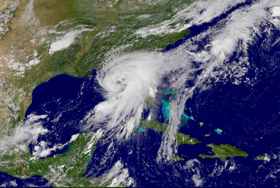
Hurricane Hermine slammed into Florida’s Big Bend in the early morning hours on Friday – packing maximum sustained winds of more than 80 miles per hour.
The fast-developing system – which formed earlier this week in the Gulf of Mexico – barreled ashore at 1:30 a.m., the first Hurricane to make landfall in Florida in over a decade.
At least a quarter million Floridians were without power in the aftermath of the storm – and extensive damage has been reported along the Big Bend coast (especially in Franklin, Wakulla, Leon, Jefferson, Taylor, Lafayette, Dixie and Levy counties).
So far no fatalities have been reported in connection with the storm – although several children in Orlando were struck by a car that careened out of control on slick roads, according to WFTV.com.
What is the current status of the storm?
As of this writing the center of Hermine – which has been downgraded to a tropical storm – is located in southern Georgia roughly 120 miles southwest of Savannah.
Tropical storm-force winds extend roughly 175 miles from the center of the system – which is moving north-northeast at approximately fourteen miles per hour. Maximum sustained winds are currently clocking in at more than sixty miles per hour.
Where is Hermine headed?
As we noted yesterday, Hermine has drawn a bead on the South Carolina Lowcountry and Grand Strand – and North Carolina’s Outer Banks.
That hasn’t changed …
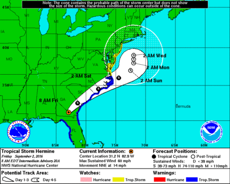
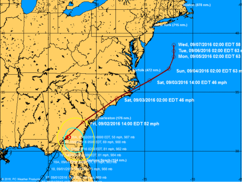
“The center of Hermine will continue to move across southeastern Georgia today, move across the coastal Carolinas tonight and move offshore of the North Carolina coast on Saturday,” analysts at the National Hurricane Center (NHC) in Miami, Florida predicted.
Here is its five-day forecast window …
(Click to enlarge)
(Via NOAA)
And here is its projected forecast track …
(Click to enlarge)
(Via BoatUS)
Hermine’s wind strength will continue to weaken as it moves over land, but it will still pack a punch in terms of rainfall and possible flooding.
“Hermine is expected to produce storm total rainfall accumulations of 5 to 10 inches over the southeastern United States from northwest Florida through southern and eastern Georgia into South Carolina and eastern North Carolina, with possible isolated maximum amounts of 15 inches,” NHC analysts noted.
There were no direct hurricane landfalls in 2015. The last hurricane to hit the United States was Arthur – which did only “minimal damage” when it skirted up the Outer Banks in July of 2014.
(Banner image via NOAA)


