SC

Hermine Hits South Carolina

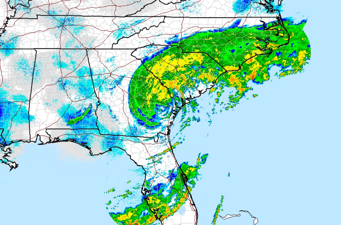
TROPICAL SYSTEM MOVING THROUGH PALMETTO STATE …  Tropical Storm Hermine crossed into South Carolina at around 2:00 p.m. EDT on Friday – bringing maximum sustained winds of more than fifty miles per hour and torrential rainfall to the state. Power outages were already being reported in multiple locations throughout the…

TROPICAL SYSTEM MOVING THROUGH PALMETTO STATE … 

Tropical Storm Hermine crossed into South Carolina at around 2:00 p.m. EDT on Friday – bringing maximum sustained winds of more than fifty miles per hour and torrential rainfall to the state.

Power outages were already being reported in multiple locations throughout the Palmetto Lowcountry, although it’s too early to estimate how many South Carolinians will lose power as a result of the storm.

As of 1:00 p.m. EDT, only 21,000 outages had been reported according to the S.C. Emergency Management Division (SCEMD) – which is coordinating the state’s response to the storm with county and municipal officials.

We expect that number to increase considerably over the next 12-18 hours, though.

The former hurricane – which slammed into Florida’s Big Bend overnight – is projected to move up the Palmetto State’s “Corridor of Shame” during the afternoon on Friday before heading toward North Carolina’s Outer Banks.

After dousing the Tar Heel State, Hermine is expected to move out to sea off the coast of North Carolina around 8:00 a.m. on Saturday, at which point it could regain hurricane strength.

As of this writing, Hermine’s center is located approximately eighty miles west-southwest of Charleston, S.C. The system is moving toward the northeast at approximately eighteen miles per hour.

Tropical storm force winds extend outward from the center of Hermine for roughly 175 miles. In fact a buoy located twenty miles east-northeast of Hilton Head Island, S.C. recorded sustained winds of 42 miles per hour and gusts of 58 miles per hour.

The good news?  Hermine isn’t expected to gain any strength during its South Carolina stay.

“Little change in strength is expected through Saturday morning,” analysts at the National Hurricane Center (NHC) in Miami, Florida predicted. “Strengthening is forecast once the center of Hermine moves offshore Saturday afternoon.”

Here’s a look at Hermine’s current five-day forecast window …

(Click to enlarge)

hermine forecast window

(Via NOAA)

And here’s a look at its forecast track …

(Click to enlarge)

hermine track

(Via BoatUS)

Forecasters warned residents in the Carolinas to be wary of flooding, storm surges and possible tornadoes associated with the storm.

Current estimates call for anywhere between 5-10 inches of rainfall across the state on average – with some areas receiving up to 15 inches.

To follow Hermine as it moves across the Palmetto State, click here.

(Banner image via Weather.gov)

***

Related posts

SC

North Charleston Councilman Accuses Cop Of Falsifying Police Report

Will Folks
SC

‘Carolina Crossroads’ Update: SCDOT Set To Unveil New Plan To The Public

Will Folks
SC

Federal Lawsuit Alleges Racial Discrimination in Horry County School

Callie Lyons

Leave a Comment